WE DELIVER PROJECTS ON TIME. EVERY TIME.
Accurate Land Surveys. Reliable GIS Solutions. Anywhere in the Philippines.
Who We Are
4Sight Geosolutions is a Surveying Firm Led By 4 Geodetic Engineers
Renz, Anjo, Ian, and Emman are a group of friends who graduated from the University of the Philippines Diliman in 2017. After years of individual practice, they started working together in 2020 — and in 2022, they built the firm together.
Since then, they've grown the team, brought in skilled engineers and field personnel, and taken on projects of every scale across the Philippines. But the four of them still lead the work and stay accountable for every output that leaves the office.
Their goal is simple: to be the premier choice for geospatial solutions and surveying services in the Philippines. They believe that happens through accurate work, honest timelines, and the same level of dedication to every project — no matter the size, no matter the location.
Ian Emerson Almazan
Geodetic Engineer/ GIS Specialist
Field Surveys · GIS and Spatial Data Processing
Anjonette Racho
Geodetic Engineer/ GPR Analyst
Project Management · Client Relations · Titling and Approvals
Emmanuel Umali
Geodetic Engineer/Environmental Planner
Field Surveys · GIS · Project Management · Regulatory Compliance
Vicente Lorenzo Castillo
Geodetic Engineer
Business Development · Project Management · Client Relations
Our Services
We offer a range of land survey and GIS solutions
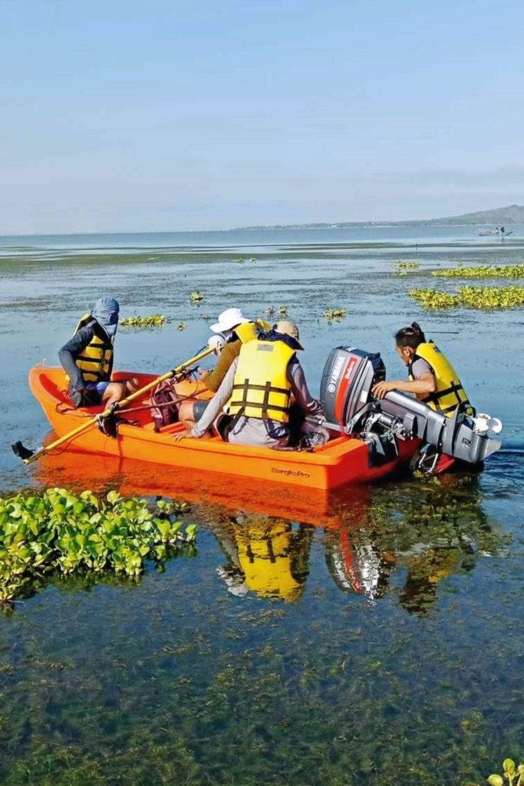
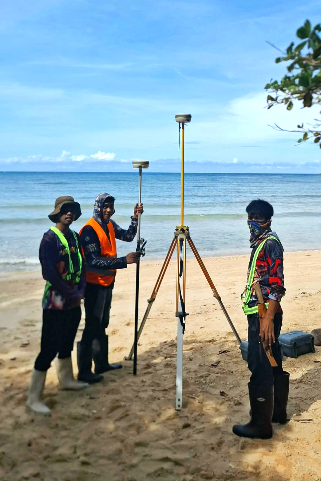
Property & Land Surveys
From boundary survey to land titling — we handle every survey your property needs.
- Boundary and Relocation Surveys
- Original Surveys
- Re-surveys
- Verification Surveys
- Consolidation and Subdivision Surveys
- Parcellary Surveys
- Land Document Processing (Titling, Transfer of Ownership, Reconstitution, etc.)
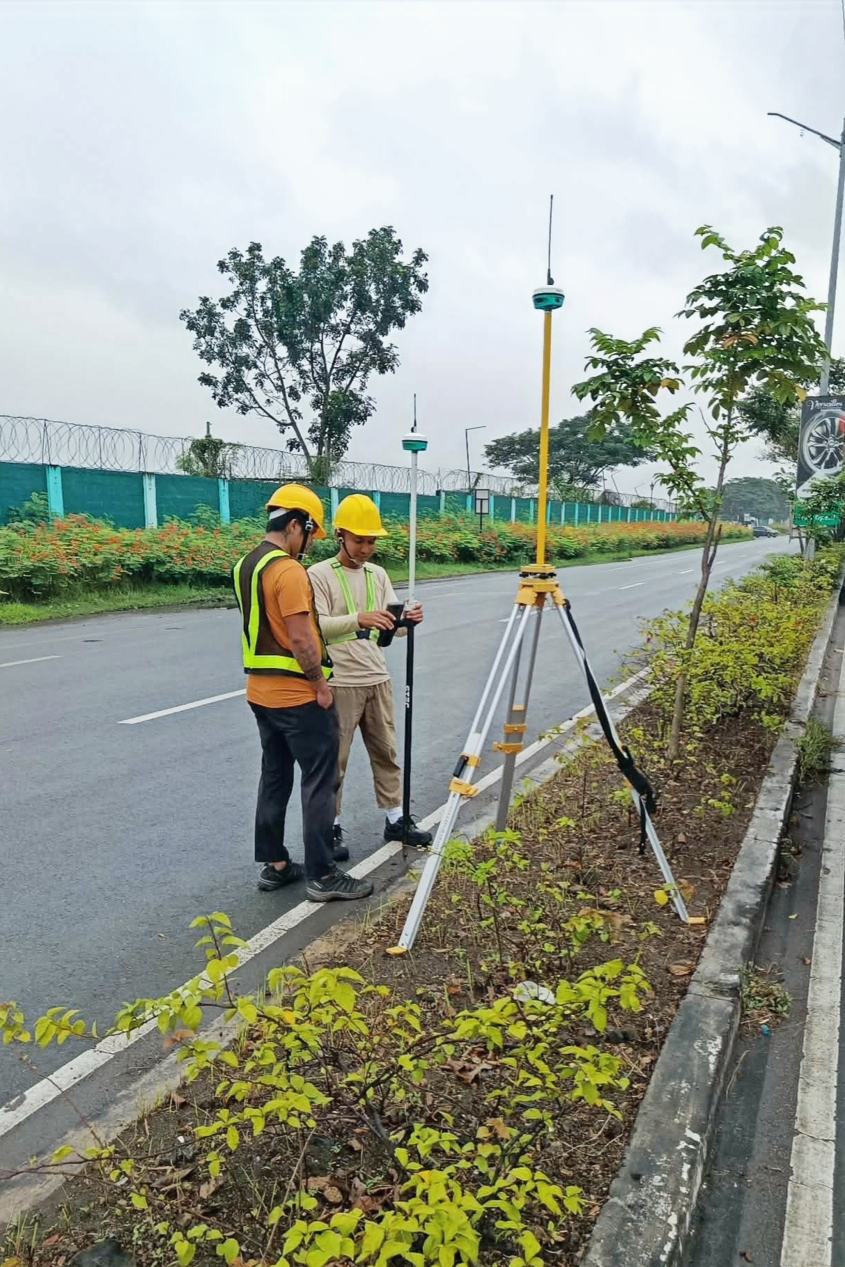
Engineering Surveys
Precise ground data for design, construction, and infrastructure projects.
-
Topographic Surveys
-
Hydrographic Surveys
-
As-Built Surveys
-
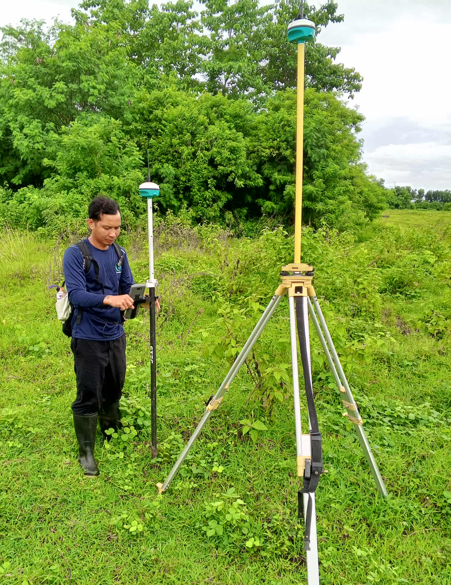
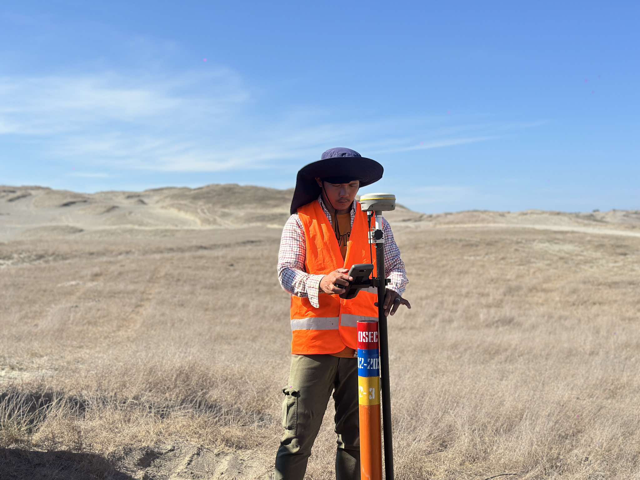
Horizontal and Vertical Control Surveys
-
CAAP Height Clearance Survey
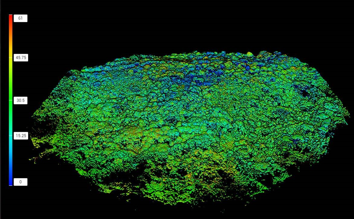
Aerial & LiDAR Surveys
High-resolution aerial mapping, remote sensing, and terrain data acquisition.
-
Aerial Photogrammetry Surveys
-
Aerial LiDAR Surveys
-
Tree Tagging Surveys
GIS & Data Processing
Spatial data management, mapping, analysis, and technical documentation.
- GIS and Cartography
- Spatial Data Processing
- DOE Mapping Compliance
Accurate Surveys, Every Time
We use advanced surveying technology and modern equipment to deliver precise, reliable data . Every output is reviewed, documented, and signed by a licensed geodetic engineer.
Clear Timelines. No Surprises.
We commit to deadlines and we keep them. Every project comes with a defined scope, a realistic schedule, and regular progress updates.
A Team That Actually Communicates
From the first inquiry to final delivery, you have a dedicated point of contact on our team. Every call gets answered, every email gets a reply, and every concern gets addressed.
Equal Dedication, Every Project
A boundary survey for a single landowner gets the same attention as a government infrastructure project. We don't have small clients — every project is handled with the same care, accuracy, and accountability.
Key Offerings
Why clients trust us
Request a Project Estimate
Share your project details and we'll respond within 24 hours
Notable Projects


4+
Years in the Field
140+
Projects Delivered
95+
Happy Clients